Sandpoint Gallery
City Information
Travelogue etc
|
New York, NY
Washington,D.C.
Braintree, MA
Columbus, GA
St. George Island, FL
Charleston, SC
San Francisco, CA
Los Angeles, CA
Pasadena, CA
Disneyland, CA
Tropical Islands
Punta Cana, Dominica
Oahu Is., Hawaii
Cebu Is., Philippines
Asian Cities
Beijing, China
Shanghai, China
Nanjing, China
Taipei, Taiwan
Manila, Philippines
Munich, Germany
Dubai, UAE
|
|
|
|
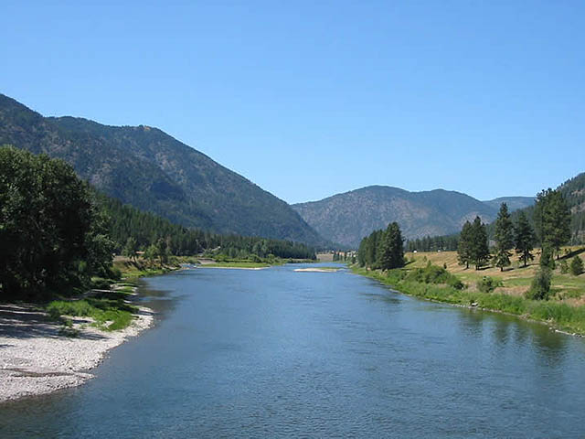
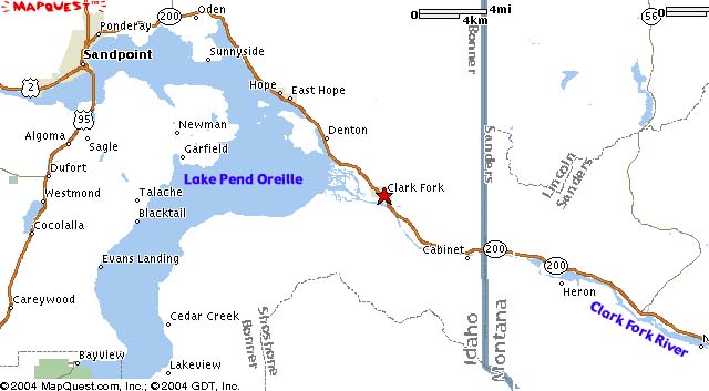
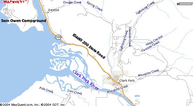
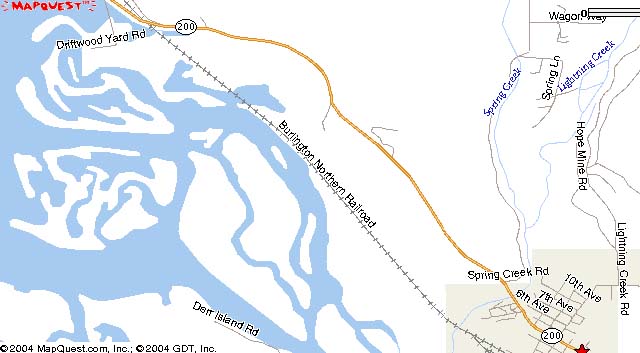
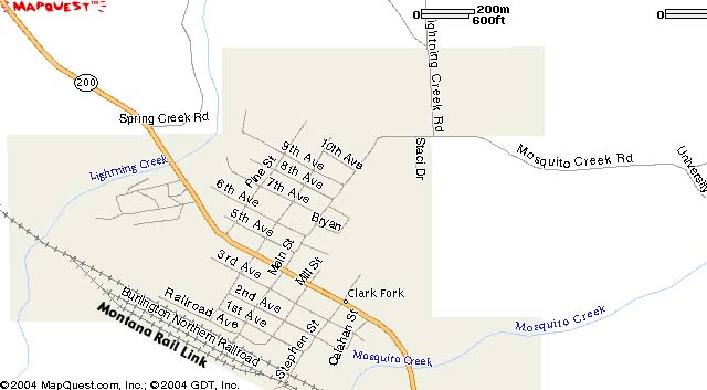
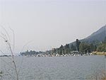
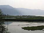
Clark Fork, Idaho
Clark Fork, City Information
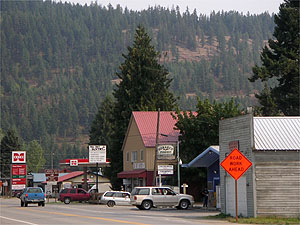
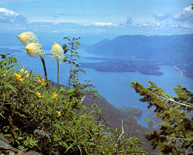
Clark Fork was established when the Northern Pacific pushed its main line through Northern Idaho in the 1880s. It is located on Idaho 200 State Highway on the eastern side of Lake Pend Oreille in Bonner County.
Population (year 2000): 530
Elevation: 2091 feet
County: Bonner
Land area: 1.0 square miles
Latitude:48.14
Longitude:116.17
Races in Clark Fork:
White Non-Hispanic (93.4%)
American Indian (3.2%)
Hispanic (3.0%)
Two or more races (2.3%)
Other race (1.7%)
Black (0.6%)
|
Clark Fork history
The City of Clark Fork became a viable town in the early 1880's during the construction by the Northern Pacific Railroad of a line through the Bitterroot and Cabinet Mountains. It has remained a small community throughout a 100 years plus of history and its citizens have seen considerable mining, logging, sawmills, farming, Forest Service activity, fish hatcheries, dam construction, fur trapping activity, collegiate studies and homes for teens. Also, for most of it's history the railroad maintained a station and section crew in Clark Fork. Clark Fork became an incorporated city in 1912.
Until WWI there was a lot of sawmill activity, then to a lesser degree through the 1950's. Early sawmills include McGillis and Gibbs, Lane and Potter. From the start until the late 1950's, mining operations played an important role in the community's economy. Approximately 75 men were employed in the mining and milling industry during the peak years. The Whitedelph mine and mill located near the Spring Creek fish hatchery began operation in 1926 and ceased in 1958. It yielded galena ore assaying principally in silver, lead and zinc. There was Lawrence mine located on Antelope Mountain near Mosquito Creek and near what is known today as the University of Idaho field campus. There are numerous other prospect holes scattered all over nearby hills.
Quoted from Key to the City
Clark Fork,Points of Interest
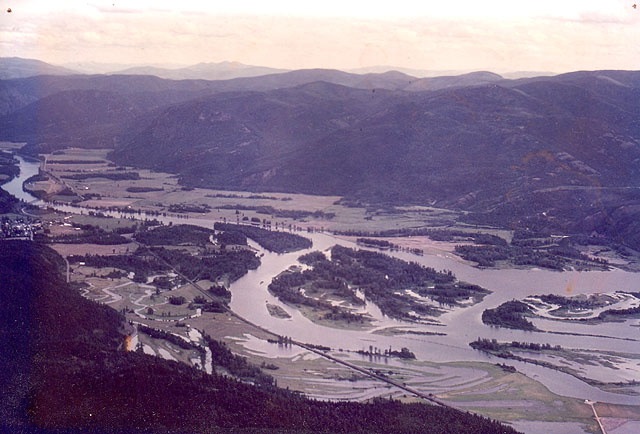
Cabinet Gorge Dam and Viewpoint
East of Clark Fork about 7.5 miles along ID 200 State Highway is the exit to Cabinet Gorge Dam viewpoint, only 1/2 mile west of the Montana border. Below the dam is the Cabinet Gorge Fish Hatchery, designed to handle 20 million Kokanee salmon annually.
Height:63.4m
Length of crown:182.9m
|
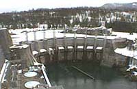
Copyright(C) Cabinet Gorge Dam
|
Lodging
MERIWETHER INN
A lovely 15-unit motel nestled in the valley of Scotchman Peak... at the gateway to the Northern Rockies. Our quiet and picturesque location offers the perfect relaxation getaway! The MERIWETHER INN is located on Hwy 200 near the Idaho & Montana border... along the breathtaking Pend Oreille National Scenic Byway. This 33 mile byway follows the northern shore of Lake Pend Oreille... then winds alongside the Clark Fork River to Montana's State line. Rooms are clean, comfortable, and affordable. Paved parking, on site laundromat, gift shop, wireless internet access, satellite TV, and complimentary coffee and newspaper come with all rooms.
Location: 121 Antelope Loop & Hwy 200
Reservation Desk: 208-266-1716
Email: meriwetherinn@gmail.com
|

|
Diamond T Guest Ranch
It offers comfortable accommodations in one of our 7 modern, wood-heated log cabins. Each sleeps up to six people and provides beautiful views of the Cabinet Mountains and the Coeur d'Alene range. They'll provide it all, plus warm hospitality to make your stay a most pleasurable one.
Location:5361 River Rd, Clark Fork
|
Copyright(C) Diamond T Guest Ranch
|
River Delta Resort
Cabins, RV Park, Boats and Motors, Fish Smokers, Freezers, Canning Facilities, Over Nighters Welcome. Rates by the day, week and month.
3 miles west of the Montana line on IDAHO 200 State Highway, 5 miles east of Clark Fork, 30 miles east of Sandpoint.
Location Star Route Box 128
Services
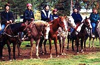
Idaho Outdoor Experience
Their outfit is on the edge of Idaho, next to the Cabinet Mountains in Idaho's Panhandle. The crystal clear waters of Lake Pend Oreille are a backdrop for our mountain trails. The Clark Fork River is a stone's throw away.
Activities include hourly riding, pack trips, hiking, assisted hiking, dinner rides, youth camps with environmental instruction, breakfast rides, wagon rides, and dutch oven cooking.
Everything is furnished except your sleeping bag and personal gear. Enjoy North Idaho licensed and bonded.
Location: Cabinet Gorge Rd. Clark Fork
|
Copyright(C) Idaho Outdoor Experience
|
Quoted from Online Highways, LLC..
|
Clark Fork Photo Gallery, 2006
|