
|
Sandpoint Gallery
City Information
Travelogue etc
|
New York, NY
Washington,D.C.
Braintree, MA
Columbus, GA
St. George Island, FL
Charleston, SC
San Francisco, CA
Los Angeles, CA
Pasadena, CA
Disneyland, CA
Tropical Islands
Punta Cana, Dominica
Oahu Is., Hawaii
Cebu Is., Philippines
Asian Cities
Beijing, China
Shanghai, China
Nanjing, China
Taipei, Taiwan
Manila, Philippines
Munich, Germany
Dubai, UAE
|
|
|
|
Sandpoint Idaho, City Map
|
City Center of Sandpoint
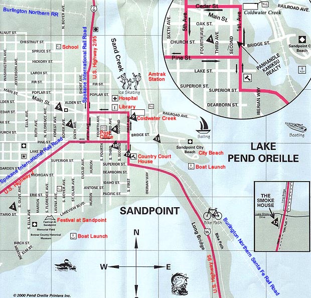
The downtown area of Sandpoint is quite small. After a few blocks walking, you will enter the residential zone. As well as all other suburban cities, the large amount of dairy marchandise will be in a big mall in suburban area. But of course the root of the city is here and MUST-VISIT area. Red colored are the U.S. National Highway 2 and 95 (2 from Spokane and 95 from Coeur d' Alene). 95 goes north on 1st Ave and turning left onto Cedar St, then turning right toward north. 2 and 95 are combined together at the crossing of 1st Ave. and Pine St.
|
Northern Area of Sandpoint
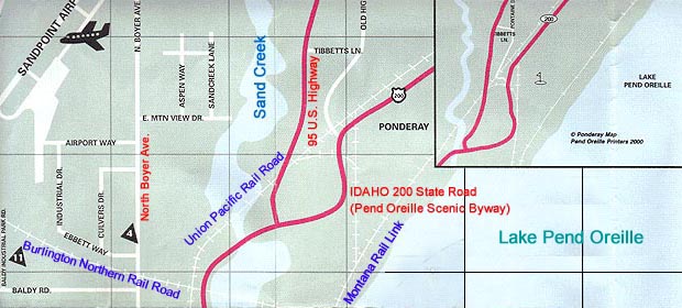
The northern gateway is 2/95 U.S. Highway. Idaho 200 State Road will start from the intersection just across the bridge over Sand Creek. The road is called " Pend Oreille Scenic Byway". While the U.S. Highway goes north toward the national border of Canada.
|
South West Area of Sandpoint
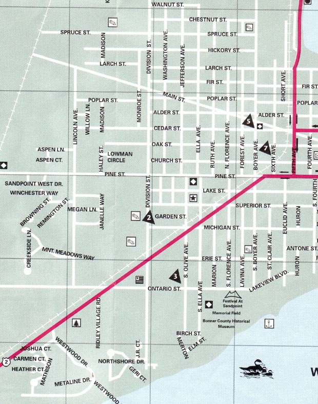
The western bounds of the residential zone is the rail road line of BNSF. You can see that the Main Street just starts from the edge of the rail road. Another rail raod line, Spokane International Rail Road runs through the center of the city and goes south-west along Pend Oreille River.
|
|
|