


Sandpoint, ID
Coeur d' Alene, ID
Spokane, WA
New York, NY
San Francisco, CA
Washington, D.C.
Braintree, MA
Columbus, GA
St. George Island, FL
Los Angeles, CA
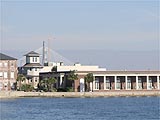
Charleston, SC
Pasadena, CA
Disneyland, CA
Tropical Island
Punta Cana, Dominica
Oahu Is., Hawaii
Cebu Is., Philippines
Asian Cities
Beijing, China
Shanghai, China
Nanjing, China
Taipei, Taiwan
Manila, Philippines
Munich, Germany
Dubai, U.A.E.
|
|
|
|
Miscellaneous Photo Gallery
You can enlarge each photo by clicking on the photo, new window will open.
|
|